
Yes, you read this right. There was a atmospheric logjam involving two high pressure systems and a former category 5 hurricane. Normally, that would not get a lot of attention especially if the hurricane (or super-typhoon) gets lodged in an open sea. However, this pattern resulted in potentially one of the worst disasters of this year.
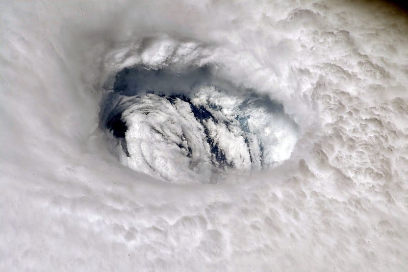
As of writing (Monday, September 2, 2019 at 1 p.m.), nearly stationary Hurricane Dorian was still battering Bahamas for at least a full day after parking itself over the islands, and Dorian was reduced to Category 4. However, it peaked at Category 5 with 185 mph sustained winds on Sunday, September 1, according to the Weather Channel. On top of that, Dorian made three separate landfalls on Sunday. First two were at Abacos Islands, and the last one took place on Grand Bahama. Dorian tied for the second strongest Atlantic hurricane in record, and the storm also tied with 1935 Labor Day Storm for strongest Atlantic hurricane to make landfall.
With context out of the way, there are several worst-case scenarios involving weather, including an EF-4/5 tornado hitting Clarksville in previous article. Sadly, one of these scenarios is still unfolding as of the writing. It’s a case of major (cat 3+) hurricane stuck over populated land in an atmospheric traffic jam. Unfortunately, that was the case of formerly high-end category 5 Dorian. According to The Weather Channel, Dorian was pinned against two high pressure systems, and there was nothing to dislodge the hurricane and steer it away since the Atlantic high pressure weakened. According to the forecast, the hurricane would not be able to move until Tuesday when it is forecast to head north. By the time Dorian should finally move, the Bahamas would have spent roughly 48 hours being lashed by an immobilized hurricane.
In the meantime, Florida and the Atlantic coast had been preparing in case Dorian makes a break for the gap between pair of high pressure systems, and it is likely that the hurricane would do so Tuesday, according to National Hurricane Center. The break could result in impact on U.S. Atlantic seaboard. For the Bahamas, the atmospheric traffic jam proved to be catastrophic.
I am a trained spotter and weather enthusiast who spent years enjoying learning about weather. I provide my thoughts and commentaries, sometimes with light humor.